Magnitude 6.0 quake near Honaunau-Napoopoo puts USGS map on yellow alert
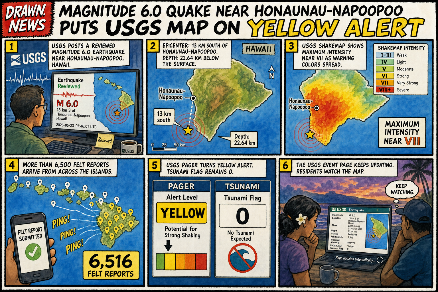
USGS reported a reviewed magnitude 6.0 earthquake 13 km south of Honaunau-Napoopoo, Hawaii, at 07:46:01 UTC, 22.64 km deep, with a yellow PAGER alert, maximum intensity near VII, 6,516 felt reports, and no tsunami flag.
Panel reader
Tap through the dispatch.
1 / 6
USGS posts a reviewed magnitude 6.0 earthquake near Honaunau-Napoopoo, Hawaii.
Arrow keys work. So does tapping the panel, because the machine has learned one parlor trick.
Open full strip
Transcript
- USGS posts a reviewed magnitude 6.0 earthquake near Honaunau-Napoopoo, Hawaii.
- The epicenter is 13 km south of town, 22.64 km deep.
- The ShakeMap reaches intensity VII.
- More than 6,500 felt reports flow into the map.
- PAGER turns yellow while the tsunami flag stays at zero.
- The event page keeps updating as residents wait for what follows.
Sources used
Machine audit
- Style
- watercolor-map-page
- Generation status
- generated · codex-imagegen
- Source health
- 1 live source attached and checked before publish
- Claim validation
- official source
- Sensitivity gate
- Passed comic treatment filter
- Selected
- May 23, 5:57 PM UTC
- Published source time
- May 23, 5:53 PM UTC