Latest briefs Browse latest →
How Tsunami Warnings Work
Tsunami warnings turn earthquake data, ocean sensors, forecast models and local evacuation calls into a race against coastal flooding.
Full visual brief
Follow the story
Sources & verification
Sources behind this guide, checked before publication.
Brief text
Tsunami warnings turn earthquake data, ocean sensors, forecast models and local evacuation calls into a race against coastal flooding.
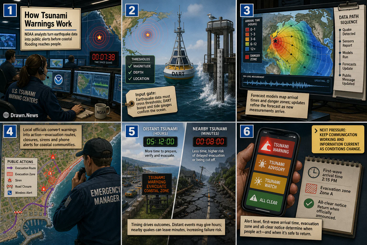
- Frame 1How tsunami warnings work: A NOAA warning center turns earthquake data into public safety alerts before coastal flooding reaches residents.
- Frame 2Input gate: location, magnitude and depth cross thresholds; DART buoys and tide gauges check the water.
- Frame 3Data path: forecast models map arrival times, danger zones and updates as measurements change.
- Frame 4Local handoff: emergency managers convert warning, advisory or watch messages into evacuation routes, closures, sirens and phone alerts.
- Frame 5Timing constraint: distant tsunamis may leave hours; nearby quakes can leave minutes and raise failure risk.
- Frame 6Watch signal: alert level, first-wave arrival time, evacuation zone and all-clear notice decide the return threshold.
How this was checked
- Reporting
- Cross-checked across 2 sources
- Claims
- We checked the names, dates, numbers, and core facts against the reporting linked above
- Artwork
- This is an editorial illustration based on the reporting, not source photography
- Published
- Jun 9, 8:11 PM EDT
- Our standards
- Editorial standards and corrections