Latest briefs Browse latest →
Storm Warnings, Explained
Briefing view
Visual briefing
1 / 6
Sources & verification
This brief was generated from the sources below and checked before publication.
Brief text
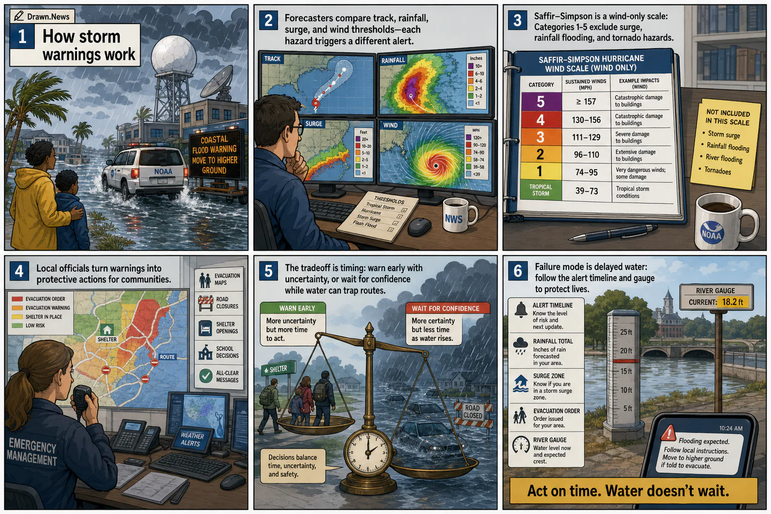
Storm warnings turn forecasts, radar, flood risk, evacuation zones and local emergency decisions into public alerts before conditions arrive.
- Frame 1The storm-warning data path turns radar, track, rain, surge, and wind into public alerts for residents at risk.
- Frame 2Forecasters compare track, rainfall, surge, and wind thresholds on maps, because each hazard triggers a different alert.
- Frame 3Saffir-Simpson is a wind-only threshold: categories 1 to 5 exclude surge, rainfall flooding, and tornado hazards.
- Frame 4The local decision chain converts warnings into evacuation maps, road closures, shelter openings, school decisions, and all-clear messages.
- Frame 5The tradeoff is timing: warn early with uncertainty, or wait for confidence while water can trap routes.
- Frame 6The failure mode is delayed water: follow the alert timeline, rainfall total, surge zone, evacuation order, and river gauge.
Verification record
- Style
- ligne-claire-city-page
- Generation status
- generated · codex-imagegen
- Source health
- 2 live sources used and checked before publish
- Claim validation
- cross-checked sources
- Sensitivity gate
- Visual treatment checked before publication
- Selected
- Jun 19, 12:03 PM EDT
- Published source time
- Pending